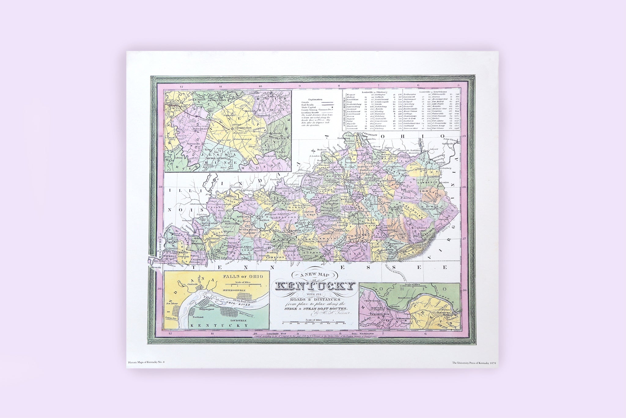
When we received a hot tip from our friends at South Hill Gallery that the University Press of Kentucky had recently found a stash of historic Kentucky maps in its archives, we knew we had to check them out. And you'll be glad that we did.
The oversized maps are all from the original 1979 printing of "Historic Maps of Kentucky" by Thomas D. Clark. Clark, Kentucky's most eminent historian and founder of The University Press of Kentucky, personally selected each of the 10 maps included in the collection for their historical significance in depicting the emergence of Kentucky, as well as for their stunning representation of the cartographer's art.
In short, they're really cool and would be an awesome addition to the home or office of any proud Kentuckian. We've secured a very limited quantity of these rare prints, and will offer them for sale beginning at 10 a.m. Friday, August 26th, exclusively in the online shop and in the Fun Mall, 720 Bryan Ave. in Lexington. These are the original, vintage reproductions included in the long out-of-print book, and once they're gone, they're gone.
We've selected five designs to offer. Each print will retail for $20 each and, beginning at 10 a.m. Friday, you can pick your favorite design while supplies last. The selection includes:

No. 3 Kentucky
"Kentucky, Reduced from Elihu Barker's Large Map. W. Barker Sculp." Engraved for Carey's American Edition of Guthrie's Geography improved." Size: 50.9 x 23.8 centimeters. First published in: William Guthrie, A New System of Modern Geography; or, A Geographical, Historical, and Commercial Grammar. 1st American edition, corrected, improved, and greatly enlarged. Philadelphia, 1794-1795.

No. 4 Kentucky with Adjoining Territories
"The State of Kentucky with, the adjoining Territories from the best Authorities 1800. Engraved for , Payne's Geography Publish'd by I Low New York." Size: 21.4 x 18.6 centimeters. In: John Payne, A New and Complete System of Universal Geography; … Describing Asia, Africa, Europe and America. … New York, 1798-1800. Map in The Filson Club, Louisville.

No. 6 A New Map of Kentucky, H. S. Tanner
"A New Map of Kentucky with its Roads & Distances from place to place along the Stage and Steam Boat Routes. by H. S. Tanner. Entered according to Act of Congress in the year 1839 by H. S. Tanner, in the Clerks Office of the Eastern District of Pennsylvania. " Size: 34.4 X 28.5 centimeters. First published in: Henry Schenck Tanner, A New American Atlas; containing Maps of the Several States of the North American Union, Projected and Drawn on a Uniform Scale from Documents found in the Public Offices of the United States. Philadelphia, 1839.

No. 7 Kentucky & Tennessee, John Bartholomew
"Kentucky and Tennessee. Drawn and Engraved by J. Bartholomew. Edinburgh. Published by A. & C. Black." Size: 38.5 x 26.9 centimeters. First published in: Black's General Atlas of the World. New edition, containing the latest discoveries, new boundaries and introductory description. Edinburgh, 1867.

No. 9 Rapids of the Ohio River, Jared Brooks
"A Map of The Rapids of the Ohio River, and of the Countries on each side thereof, so far, as to include the routes contemplated for Canal Navigation Engrav'd & Printed by John Goodman Frankfort Kentucky 1806 Respectfully Inscribed to His Excellency Christopher Greenup Governor of Kentucky by His very Obedient Servt J. Brooks." Size: 50.3 x 38.6 centimeters.
Select your favorite map beginning at 10 a.m. Friday, August 26th, in the online shop and in the Fun Mall. And don't miss our EPIC $10 PRINT SALE this weekend!


